Featured Routes
Manigotagan River
Whitewater river in eastern Manitoba (3-4 days)
What’s included:
Route overview
Map legend & user guide
Custom double-sided laminated maps

-
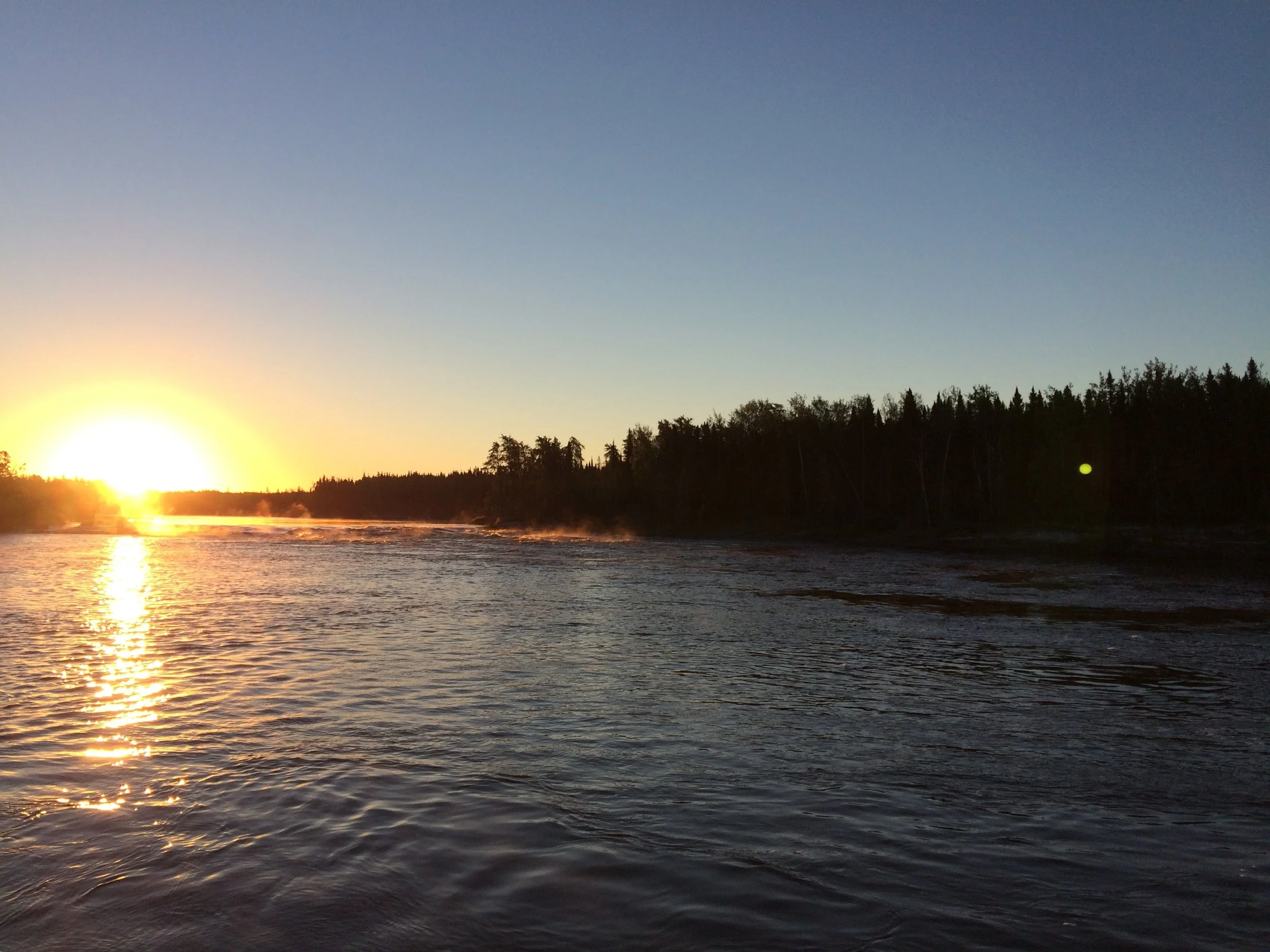
The Manigotagan River is a scenic river in northeastern Manitoba which runs between two secondary provincial highways that allow for easy access and egress. The river flows into Lake Winnipeg in the west, and connects in the east to Nopiming Provincial Park in Manitoba and Woodland Caribou Provincial Park in Ontario; allowing for the river to be done as a long weekend adventure, or the finally of a longer expedition. Known for its clear waters, it offers calm sections of paddling as well as more challenging rapids for experienced paddlers. Most rapids are <100 meters and rated between C1-C3. All rapids have established portages for scouting and to allow paddlers of all levels safe descent of this river safely. Surrounded by dense forests, the river supports diverse wildlife and provides a peaceful retreat for outdoor enthusiasts. Historically important for Indigenous cultures and fur trade routes, it remains a pristine and unspoiled natural area.
-
Multiple C1-3 rapids, several Falls and C4/C5 rapids. Most rapids are less than 100m, with calm water afterwards. Attention: Windigo Rapids stretches for 1km, and can be circumvented by a portage.
Several road access points allow for different length trips along the river as well as serving as emergency evacuation points.
Isolation: Likely to meet boaters on Quesnel Lake, but only canoers on the river itself.
Most campsites have a toilet; Quesnel Lake has 3 campsites maintained & reserved by Jackson Lodge.
Black bears are present throughout.
-
Route can be accessed by car at several points along the river which will require driving on gravel roads. Only the egress point on Provincial Highway 314 is on a paved road. A local shuttle service is available in the area.
-
Skills Level: Moderate. White-water experience required.
Duration: 70km-100km (3-5 days)
With an access point at Caribou Landing, the river can be run in its full 100km or a shorter 70km trip.
White Otter Castle
Flatwater loop in Northwestern Ontario (3-5 days)
What’s included:
Route overview
Map legend & user guide
Custom double-sized laminated maps

-
Canoeing to White Otter Castle on White Otter Lake is a unique and scenic adventure, and is suitable for paddlers of all levels. There are several routes with varying levels of difficulty and portages. The most straightforward requires only 1 portage!
Paddlers glide through clear waters, surrounded by dense forests and rugged landscapes, as they approach the iconic log castle. The journey offers a peaceful, immersive experience in nature, with views of pristine wilderness and the chance to spot wildlife along the way. Once at the castle, the historic site—built single handedly by Jimmy McOuat in the early 1900s—adds a fascinating cultural element to the adventure, making it a memorable outing for outdoor enthusiasts.
-
Number of portages variable between 4 possible route options.
Route A: 1 Portage
Route B: 3 Portage
Route C: 5 Portages
Route D: 3 Portages
Route E: 4 Portages
Isolation: You are likely to meet boaters and other canoers on this popular and accessible route.
Black bears are present throughout.
-
Route has several access points by car some of which require driving on gravel roads.
-
Skills Level: Beginner; no white-water experience required.
Duration: 50km loop or 30km loop (3-5 days)
Bloodvein River
Expedition adventure on one of Manitoba’s Heritage Rivers.
What’s included:
Route overview
Map legend & user guide
Custom double-sided laminated maps

-
The Bloodvein River (Miskwewesibi River) includes intense sections of whitewater requiring advanced paddling and swiftwater rescue experience to descend safely, and posing a welcome challenge for experienced paddlers.The river winds through northern sections of boreal forest highlighted with mixed stands of jack pines, black spruce, trembling aspen, and birch trees growing from the granite of the Canadian sheild. Paddlers will also traverse wide sections of marsh and flat water that make the Bloodvein feel more like a lake than a river. This river has several means of access, including paddling in from the east starting at Red Lake, Ontario, or up through Manitoba and connecting via the Gammon River. As a heritage river, the Bloodvein attracts many paddlers each year and hosts several private Lodges within the Woodland Caribou Provincial Park, however it continues to remain an experience steeped in northern isolation.
-
Multiple C4-5 rapids and waterfalls alonng this route. Majority of rapids are C2-3, and the majority are less than 100m, with calm water afterwards.
There is no road access along the length of the river until you reach Bloodvein Village on Lake Winnipeg. However, access points via floatplane are plentiful.
This is an isolated river with no cell reception. All paddlers are encouraged to bring a satellite-enabled communication device.
Wind can be an issue in areas where the river widens.
Campsites and portages are rustic and not professionally maintained.
Black bears & wolverines are present throughout.
-
Access: Paddlers can drive to Red Lake, Ontario and paddle east. Portage up through the Gammon River, or hire a float plan to drop them off at a variety of stops throughout the length of the River.
Egress: The river ends in Bloodvein Village which has an unpaved road. Or continue your journey either north or south into Lake Winnipeg. A float plan can be landed on many points along the length of the River for emergency or pre-planned exit off the river.
-
Skills Level: Moderate to Expert; white-water experience required.
Duration: 300km River (16-20 days)
